Why were beneficiaries of the trust changed from “those resident in the Parish of Steep” to “those resident in the Parish of Steep and the adjoining Parishes”, to the detriment of the residents of Steep?
Steep Parish Council attempted to answer this by saying at the November 2019 public meeting:
“So Steep In Need were establishing new objects and, erm, they eventually were able to arrive at the statement you see on the screen there now so, “It is the prevention and relief of poverty for the public benefit among persons who are in need, hardship or distress and are resident in the parish of Steep and adjoining parishes,” and immediately I can think oh, why adjoining parishes you might think, why, why not just Steep? The [addition of] adjoining parishes is because of course the original Inclosures Act was to the parochial parish of Steep which was a very different border to the civil parish of Steep today.“
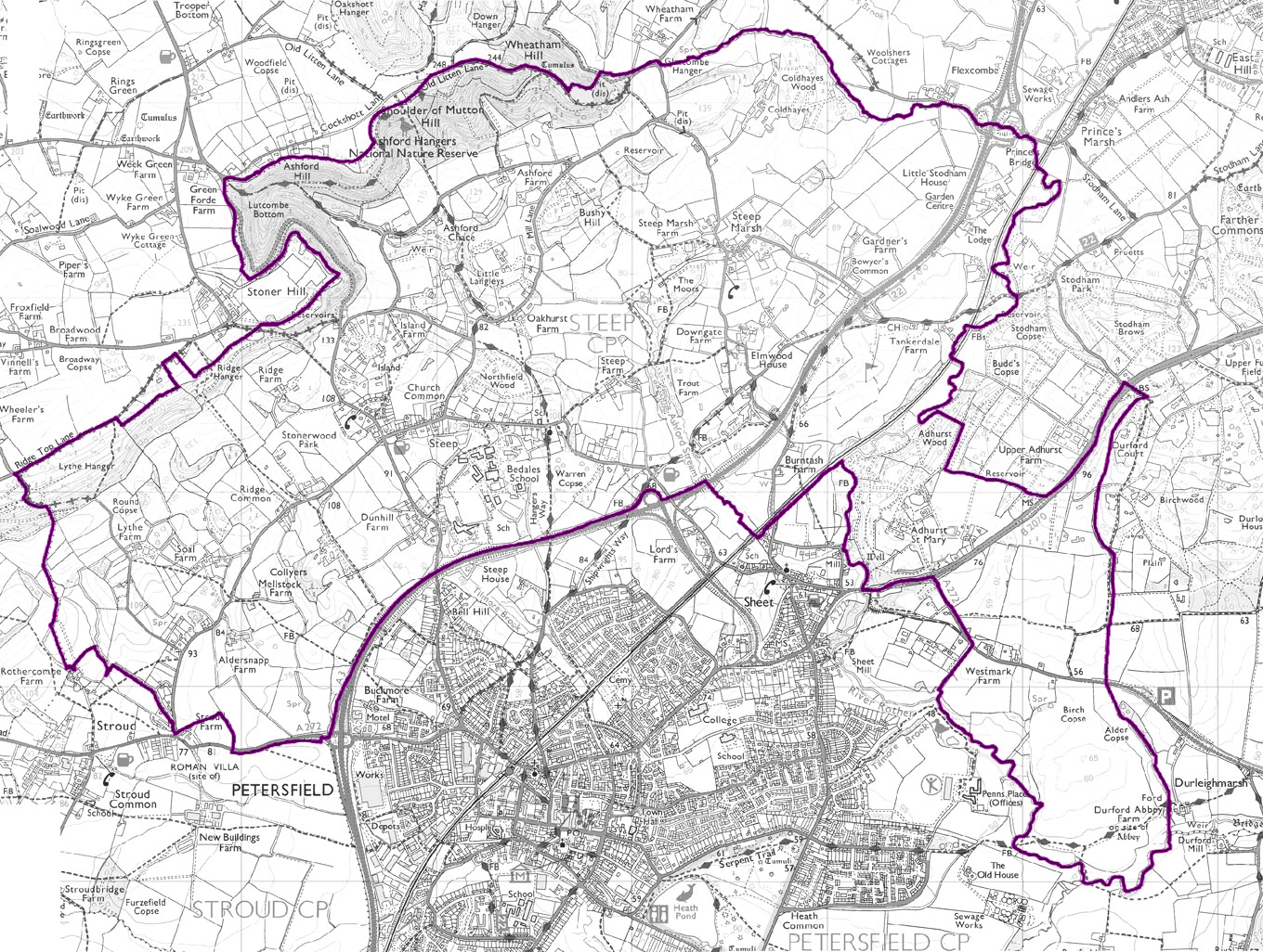
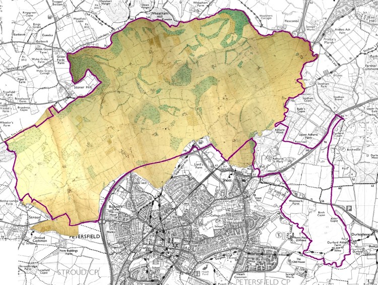
In c. 1900, the area of the Parish of Steep was 2,658 Acres (which is 10.75 km2); In 2020, the area of the Parish of Steep was 3,032 Acres (which is 12.27km2)*.
This shows that in 2020, the Parish of Steep is 14% larger by area than it was in 1900, reflecting of course the changes that have taken place since.
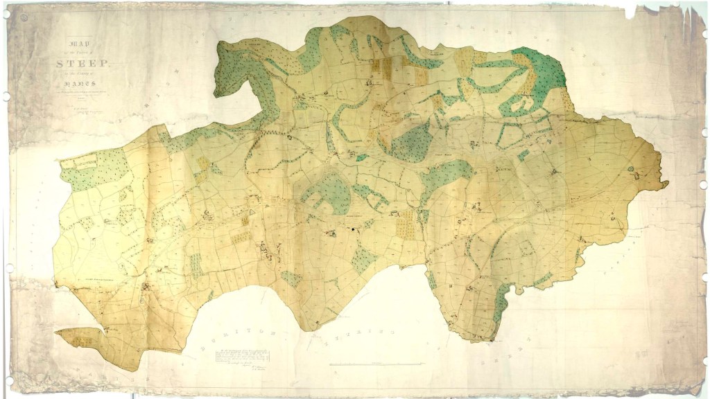
Under the Inclosure Award of September 1866, the Church Road allotments were to be held “in trust as an Allotment for the Labouring Poor of the said Parish [of Steep]”. A map dated 1857 accompanied that award showing the three allotments which formed the subject matter of the Award.
In about October 2013, the beneficiaries of the trust were changed at the behest of Steep in Need from those resident in the Parish of Steep to “residents in the parish of Steep and adjoining parishes”.
The adjoining Parishes with their respective population at 2020 appear* to be Petersfield (14,681), Sheet (956), Stroud (430), Langrish (308), Froxfield and Privett (983), Hawkley (501), Liss (6,441), Rogate (1,631), and Harting (1,429).
The population of Steep in 2011 was 1391 and in 2020 it was 1,479*;
The population of Steep and the adjoining parishes is 28,839.
*https://citypopulation.de/en/uk/southeastengland/admin/east_hampshire/E04004522__steep/
© Crown Copyright. Ordnance Survey. 2012
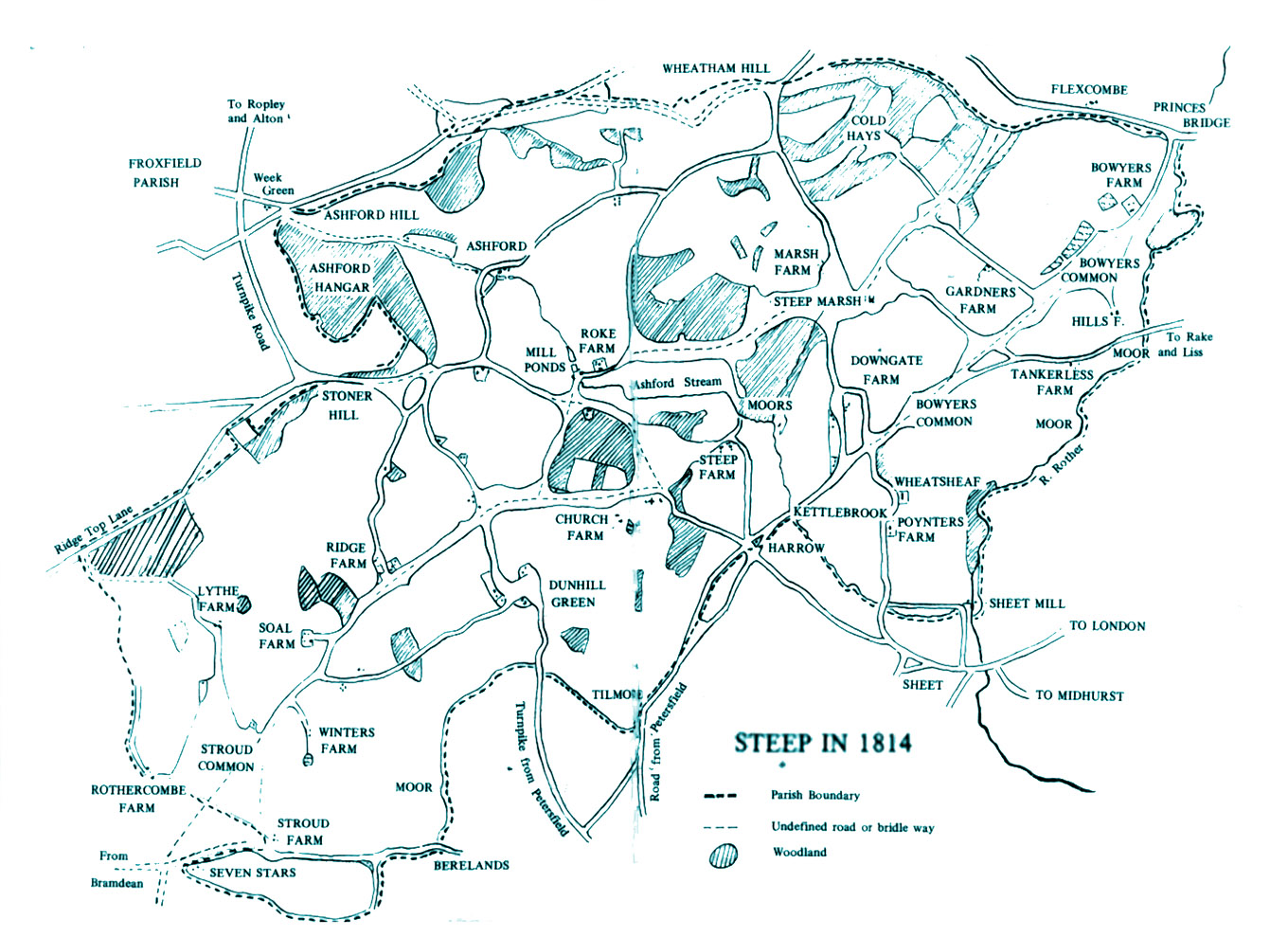
© Crown Copyright. Ordnance Survey. 1814.
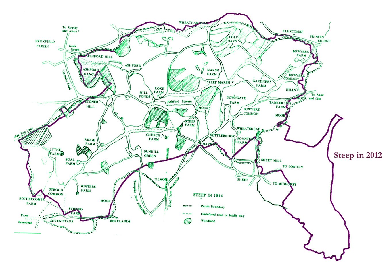
Steep Parish 1814. © Crown Copyright. Ordnance Survey. 1814.
© Crown Copyright and database rights 2020 Ordnance Survey 100054682.
Contains Ordnance Survey data © Crown Copyright and database right 2020.
